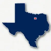
Click name to view trail
Arcadia Trail Park32.87342, -97.2759532.87342-97.2759513
Bedford Trail32.85814, -97.1256232.85814-97.1256215
Bicentennial Park32.94327, -97.1553432.94327-97.1553416
Big Bear Creek Greenbelt32.90391, -97.1057932.90391-97.1057914
Buffalo Ridge Park Trail32.84873, -97.2744132.84873-97.2744114
Cotton Belt Trail32.88795, -97.1747632.88795-97.1747612
Cross Timbers Park Trail32.88647, -97.2258732.88647-97.2258716
C. Shane Wilbanks Trail32.95891, -97.1022332.95891-97.1022315
Green Valley Community Park Paths32.88588, -97.2128032.88588-97.2128016
J. B. Sandlin Park Trail32.89418, -97.1906232.89418-97.1906216
JoAnn Johnson Trail32.82930, -97.2327432.82930-97.2327415
John Barfield Trail32.89735, -97.2142832.89735-97.2142814
Little Bear Creek Trail32.89516, -97.2354032.89516-97.2354015
North Electric Trail32.85176, -97.2093132.85176-97.2093115
Oak Grove Trail32.95625, -97.0858432.95625-97.0858415
Randy Moresi Trail32.82771, -97.2142032.82771-97.2142016
Walkers Creek Trail32.85688, -97.2000832.85688-97.2000814

Click the Key
for more info

* 00B
00B
SHOW TRAIL ONLY
MEASURE
UNDO LASTCLEAR
Latitude, Longitude
| Doubleclick trail for name | Zoom in to see parking |
X
The colored lines on the map represent the location of a recreational trail (paved or unpaved pathway)
To determine if a trail is paved or unpaved, you can turn on Satellite view at the upper right corner of the map and zoom in for more detail
Not all trails are appropriate for all activities, bike riding, walking, dog walking, running, etc.
Follow local regulations when using the trails
The location of trails in heavily wooded areas is approximate
Any city boundary shown on the map is approximate
Click here to view nearby trails

X
P
C