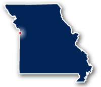
Map of the Blue River Parkway Trail
Blue River Parkway Trail

Blue River Parkway Trail
LENGTH:
3.6 miles
SURFACE:
paved
COMMUNITIES:
Kansas City
HIGHLIGHTS:
natural areas along Blue River, Blue River Park, Alex George Lake, Minor Park, residential neighborhoods
NEARBY TRAILS:
RELATED LINKS:
The Blue River Parkway Trail is a 3.6 mile long paved pathway located in the Kansas City area of Western Missouri. The trail meanders through the natural area along the river from just south of Bannister Road to the south end of Minor park, to either side of State Highway 50. The trail goes through the thick woodlands and past wetlands along the river and provides a way to see some of the local wildlife. The route includes some local parks with athletic fields and other amenities.
Conditions
The Blue River Parkway Trail is paved for the entire route. The trail is open for bike riding, walking and running.
Communities
The Blue River Parkway Trail goes past the following communities: Kansas City.
Points of Interest
The Blue River Parkway Trail goes past the following points of interest:
| Indian Creek Trail |
| Kansas City Missouri 3 & 2 Athletic Fields |
| Blue River Park |
| Alex George Lake |
| Minor Park |
Nearby Trails
Indian Creek Trail: The north end of the Blue River Parkway Trail connects to the 3.5 mile long Indian Creek Trail that heads to the west as far as State Line Road. The Indian Creek Trail connects to the Indian Creek Hike and Bike Trail and the Tomahawk Creek Trail in Kansas.
End Points
The north end of the Blue River Parkway Trail is located at a point to the southwest of the interchange between Route W and Blue River Road on the south side of Kansas City. This location is also the eastern end of the Indian Creek Trail
The south end of the trail is located at the south end of Minor Park. The park is located at Blue River Road and E. Red Bridge Road.
Resources
Following are links to official off-site resources to find out more details about the recreational trails located in Kansas City, Missouri.


Tweet