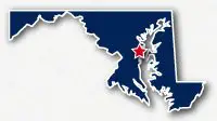
Map of the Baltimore and Annapolis Trail
Baltimore and Annapolis Trail

Baltimore and Annapolis Trail
LENGTH:
13.4 miles
SURFACE:
paved
COMMUNITIES:
Glen Burnie, Pasadena, Millersville, Saverna Park, Arnold, Manresa, Annapolis
HIGHLIGHTS:
rail trail, Baltimore/Washington International Thurgood Marshall Airport, local communities, commecrial centers, residential neighborhoods
NEARBY TRAILS:
John Overstreet Connector
BWI Trail
Kinder Farm Park Trails
RELATED LINKS:
The Baltimore and Annapolis Trail, B&A Trail, is a 13.4-mile long paved pathway that spans between the cities of Glen Burnie and Annapolis in Maryland.This area is located to the south of Baltimore and north of Annapolis.
The trail follows the route of an abandoned railroad right-of-way and travels diagonally through several communities to the north of Annapolis. The northwest end of the Baltimore and Annapolis Trail is located near the Baltimore/Washington International Thurgood Marshall Airport. The trail is used by people commuting to work, school or to the airport by bike as well as for recreational purposes.
Conditions
The Baltimore and Annapolis Trail is paved for the entire route. The trail is open for bike riding and walking. There are numerous street crossings along the route and the route goes through urban and suburban areas.
Communities
The Baltimore and Annapolis Trail goes past the following communities: Glen Burnie, Pasadena, Millersville, Saverna Park, Arnold and Manresa.
Points of Interest
The Baltimore and Annapolis Trail goes past the following points of interest:
| Baltimore/Washington International Thurgood Marshall Airport |
| Sawmill Creek Park |
| Glen Burnie Hgih School |
| Corkran Middle School |
| Marley Station Mall |
| Kinder Farm Park |
| Severna Park High School |
| Severna Park Elementary School |
| Olde Severna Park |
| Sullivan Cove |
Nearby Trails
John Overstreet Connector and BWI Trail: the northwest end of the Baltimore and Annapolis Trail meets the John Oversteet Connector in the City of Glen Burnie. The connector is a paved pathway that heads west to intersect the BWI Trail that wraps around the airport.
Kinder Farm Park Trail: the comes within a few blocks of Kinder Farm Park in Millersville.
End Points
The northwest end of the Baltimore and Annapolis Trail is located near the intersection of 8th Avenue NW and Baltimore Annapolis Boulevard in Glen Burnie. This located is to the southeast of the Baltimore/Washington International Thurgood Marshall Airport.
The southeast end of the trail is located along Winchester Road near Summers Run and Boulters Way in Annapolis.
Resources
Following are links to official off-site resources to find out more details about the Baltimore and Annapolis Trail in Maryland.


Tweet