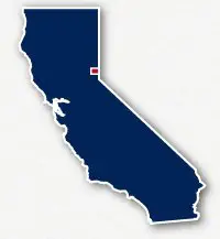
Map of bike paths / walking paths in the Truckee area
Recreational trails for walking, running and cycling in Truckee, California
Truckee is located just west of the state line with Nevada and north of Lake Tahoe in Northern California. The town is situated along the Truckee River and just south of Interstate 80. Truckee is a 13-mile drive north of Lake Tahoe.
This area of the state is rich with the history of the California Gold Rush and the infamous Donner Party. Located in the northern portion of the Sierra Nevada mountains, the area is also known for its skiing, hiking and comping.
Truckee River Legacy Trail
The Truckee River Legacy Trail is a 5-mile long paved pathway that follows alongside the Truckee River from the Truckee River Regional Park to Glenshire Drive. The trail has a branch that reaches to the Riverview Sports Park and a bridge that crosses the river to access East River Street. The trail is paved the entire route and has no street crossings.
Most of the trail travels through the natural areas with scrub brush and evergreen trees. The far east end has a bit of a climb and some switchbacks to reach the neighborhoods along Glenshire Drive.
Resources
Following are links to official off-site resources to find out more details about the recreational trails for bike riding, running and walking located in Truckee, California.


Tweet