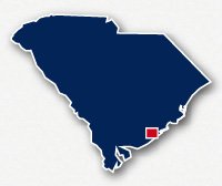
Map of bike paths / walking paths in the Charleston area
Recreational trails for walking, running and cycling in Charleston, South Carolina
Charleston is a historic port city that is located at the point where the Ashley River and the Copper River meet before pouring into the Atlantic Ocean. Charleston is the oldest city in America, dating back to before the American Revolution. Other communities in this area include Mt. Pleasant, Daniel Island and West Ashley.
Cooper River Bridge Path and Memorial Waterfront Park
The Cooper River Bridge Path is a designated lane for bikes and pedestrians on the Highway 17 bridge across the river between Charleston and Mt. Pleasant. At the east end of the bridge, trail users can connect to the paved pathways at the Memorial Waterfront Park. These trails include the Mt. Pleasant Pier.
The east end of the Cooper River Bridge Path also connects to multi-use paths along Harry M. Hallman Jr. Boulevard and Patriots Point Road. Patriots Point Road leads to the Charleston Harbor and Marina.
West Ashley Greenway
The West Ashley Greenway is an 8.3-mile long paved pathway that is located to the west of Charleston. The trail was constructed along an abandoned railroad right-of-way and takes a straight route between Main Road and Abermarle Road in the community of West Ashley.
The west end of the West Ashley Greenway crosses wetlands along a long causeway. Heading east the trail parallels the Savannah Highway, but the route is about 0.1 miles to the south. The trail goes through residential neighborhoods and ends just west of the Ashley River.
West Ashley Bikeway
The West Ashley Bikeway is a 2.5-mile long paved pathway located to the west of Charleston. The trail travels through residential neighborhoods between Wappo Road and the Ashley River. The east end of the trail is a 0.4-mile long causeway that crosses the wetlands adjacent to the river.
Daniel Island Path
Daniel Island is a community located to the northeast of Charleston. This area has numerous paved pathways that wander through the neighborhoods and along the Wando River.
Resources
Following are links to official off-site resources to find out more details about the recreational trails located in Charleston, South Carolina.


Tweet