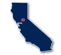
Map of the American River Parkway - Jedediah Smith Memorial Trail
American River Parkway - Jedediah Smith Memorial Trail

American River Parkway - Jedediah Smith Memorial Trail
LENGTH:
32 miles
SURFACE:
paved
COMMUNITIES:
Sacramento, Carmichael, La Riviera, Rancho Cordova, Gold River, Folsom
HIGHLIGHTS:
Sacramento River, Historic Sacramento, local parks, California State University, schools, Lowr Sunrise Recreation Area, Lake Natoma, Folsom Lake
NEARBY TRAILS:
Sacramento River Parkway
Two Rivers Bike Trail
Sacramento Northern Bike Trail
Folsom South Canal Trail
Folsom Lake Crossing Bike Trail
RELATED LINKS:
The American River Parkway is a 32-mile long paved system of bike and pedestrian paths that follows along the American River through the Sacramento, California, area. The trail system is also referred to as the Jedediah Smith Memorial Trail. The trail splits into multiple trails in some locations and along the route of the trail there are access paths to local neighborhoods and major roadways.
This trail system connects multiple parks, neighborhoods, business districts and major roadways along its route. It is the shining star of recreational trails in this area and offers a wonderful way to get through town for commuters, a lovely walk through trees and grassy parks for those going for a stroll, a mecca for bird-watchers and a excellent place for a family outing. There are large expanses of natural areas along portions of the trail.
Conditions
The American River Parkway is paved for its entire route, but may have access paths and adjacent trails that are not paved. The trail is open for bike riding, running and walking. Most of the route is away from streets and traffic with only a few road crossings.
The trail location may be on one or the other side or both sides of the river. There are a number of bridges crossing the Sacramento River along the route.
Communities
The American River Parkway goes past the following communities: Sacramento, Carmichael, La Riviera, Rancho Cordova, Gold River and Folsom.
Points of Interest
The American River Parkway goes past the following points of interest:
| Jiboom Street Bridge | Banister Park |
| Discovery Park | Fair Oaks Bridge |
| Campus Commons Golf Course | Nimbus Fish Hatchery |
| California State University Sacramento | Nimbus Dam |
| Rio Americano High School | Hazel Avenue Bridge |
| Harrington Way Stopping Point | Nimbus Dam Recreation Area |
| William B. Pond Recreation Area | Iron Point Station |
| River Bend Park | Willow Creek Recreation Area |
| Cordova Community Center | Mississippi Bar |
| Peterson Field | Rollingwood Bluffs |
| Hagan Community Park | Negro Bar |
| Cordova High School | Folsom Powerhouse State Historic Park |
| Sacramento Bar | Dan Russel Rodeo Arena |
| Lower Sunrise Recreational Area | Beals Point |
Nearby Trails
Sacramento River Parkway & Two Rivers Bike Trail: the three trails converge at Tiscornia Park at the western end of the American River Trail.
Sacramento Northern Bike Trail: the two trails meet neat the bridge for the N. Sacramento Freeway in Sacramento.
Folsum South Canal Trail: the two trails meet at the Nimbus Dam Recreation Area in Gold River.
End Points
The western end of the American River Trail is located at the Jibboom Street Bridge in Sacramento.
The eastern end of the trail is located at Beals Point off of Auburn Folsum Road in Folsum
Resources
Following are links to official off-site resources to find out more details for the American River Parkway - Jedediah Smith Memorial Trail, California


Tweet