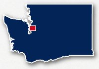
Map of bike paths / walking paths in Seattle-Tacoma Metro Area, WA
Recreational trails for walking, running and cycling in the Seattle-Tacoma Metro Area
Seattle and Tacoma are located on Puget Sound area of the western side of the State of Washington. This is the largest urbanized area in the state with one of the largest port areas on the West Coast and one of the fastest growing cities in the west. It is close to the border with Canada and you can catch ferries to take you up to Vancouver, British Columbia. It is also a very beautiful area with views of Mt. Rainier to the southeast and all the lovely scenery along the waterfront.
The various communities that exist in the Seattle-Tacoma Metro Area incude: Seattle, Tacoma, Bellevue, Kirkland, Shoreline, Woodinville, Redmond, Sammamish, Mercer Island, Federal Way, Auburn, Puyallup, Milton, Lakewood, and Kent.
The Seattle-Tacoma area offers much in the way of outdoor recreation. This area also has many recreational trails for getting around, sight-seeing and access to parks and areas that you would never see from a car window. You can use the trails to commute about town, experience the forest or the wetland estuaries or just to enjoy all the beautiful views of the waterfront and the Olympic Peninsula.
Regional Recreational Trails in the Seattle-Tacoma-Redmond Metro Area
The chart below lists many of the major recreational trails in the Seattle Metro area. Trail names in red will link to a map and article for that particular trail.
Trail names in red are links to a map and description for that specific trail.
![]() Click on the "key" symbol in the main map to open up the list of trails and zoom into specific trails.
Click on the "key" symbol in the main map to open up the list of trails and zoom into specific trails.
| TRAIL NAME | LENGTH (MI.) |
SURFACE | COMMUNITIES |
|---|---|---|---|
| 520 Bike & Pedestrian Trail | 11 | paved | Seattle, Medina, Bellevue, Redmond |
| Alki Trail | 5.3 | paved | Seattle |
| Burke-Gilman Trail | 12.8 | paved | Seattle, Lake Forest Partk, Bothell |
| Cedar River Trail | 17.3 | paved / unpaved | Renton, Maple Valley, Ravensdale |
| Cheshiahud Union Lake Loop | 5.5 | paved | Seattle |
| Chief Sealth Trail | 4.5 | paved | Seattle |
| Cross Kirkland Corridor | 5.8 | unpaved | Kirkland |
| Discovery Park Loop Trail | 2.6 | paved | Seattle |
| Duwamish Trail | 2.8 | paved | Seattle |
| East Lake Sammamish Trail | 11 | paved | Sammamish |
| East Side Rail Corridor - Bellevue | 1 | paved | Bellvue |
| East Side Rail Corridor - Newcastle/Renton | 4 | paved | Newcastle, Renton |
| Elliott Bay Trail | 5.5 | paved | Downtown Seattle |
| Foothills Trail | 25 | paved | Puyallup, Orting, South Prairie, Enumclaw |
| Green River Trail | 19 | paved | Kent, Tukwila |
| Interurban Trail (North) | 20 | paved | Seattle, Shoreline, Edmonds, Everett |
| Interurban Trail (South) | 14.7 | paved | Tuckwila, Orilla, Kent, Auburn, Algona, Pacific |
| Lake Youngs Trail | 9 | paved | Renton |
| Mountains-to-Sound Trail | 8 | paved | Seattle, Mercer Island, Bellvue |
| North Creek Trail | 5 | paved | Woodinville, Bothell |
| Sammammish River Trail | 10.9 | paved | Redmond, Woodinville, Bothell |
| Snoqualmie Valley Trail | 31.5 | unpaved | Duvall, Novelty, Carnation, Snoqualmie, North Bend, Riverbend, Edgewick |
| Soos Creek Trail | 5.8 | paved | East Hill Meridian, Kent, Covington |
| South Ship Canal Trail | 2 | paved | Seattle |
| Tolt Pipeline Trail | 9.4 | unpaved | Bothell, Cottage Lake, Woodinville |
Resources
Following are links to official off-site resources to find out more details about recreational trails for bike riding, walking and running in the Seattle-Tacoma Metro Area, Washington.
Seattle: 2015 Bike Map (very large .pdf file)
Seattle: SDOT Interactive Bicycle Map
University of Washington: Washington Botanic Gardens Map
Seattle: Cheshiahud Lake Union Loop Trail Map
Mountains-to-Sound: Interactive Map
WSDOT: Maps for Local Bicycle Paths and Pedestrian Accessible Trails
City of Bellevue: Trails Plan Map
City of Kirkland: Trails and Parks Guide
Mercer Slough Nature Park Trail Map
Communitytransit.org: 2014 Bike Maps
Snohomish County Area: Bicycling & Trail Map


Tweet