

Map of bike paths / walking paths in the Seattle, Washington area
Recreational trails for walking, running and cycling in the Seattle and Bellevue Area
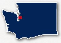
Seattle, Washington
![]() Click on the key symbol in the main map to zoom into specific trails.
Click on the key symbol in the main map to zoom into specific trails.
BIKE PATHS / WALKING PATHS
Alki Trail
Burke-Gilman Trail
Cheshiahud Union Lake Loop
Chief Sealth Trail
Discovery Park Loop Trail
Duwamish Trail
East Side Rail Corridor (Bellevue)
East Side Rail Corridor (Newcastle)
Green Lake Park
Interurban Trail - Seattle to Everett
Interurban Trail - King County
Lake Washington Boulevard Trail
Seward Park Trail
South Ship Canal Trail
RELATED LINKS
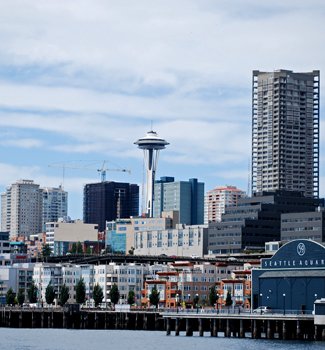
Seattle and Bellevue are located on Puget Sound area of the west coast of the State of Washington. This is the largest urbanized area in the state with one of the largest port areas on the West Coast and one of the fastest growing cities in the west. It is close to the border with Canada and you can catch ferries to take you up to Vancouver, British Columbia. It is also a very beautiful area with views of Mt. Rainier to the southeast and all the lovely scenery along the waterfront.
The Seattle area offers much in the way of outdoor recreation. This area also has many recreational trails for getting around, sight-seeing and access to parks and areas that you would never see from a car window. You can use the trails to commute about town, experience the forest or the wetland estuaries or just to enjoy all the beautiful views of the waterfront and the Olympic Peninsula.
Elliott Bay Trail
The 5-mile long paved path of Elliott Bay Trail wanders along the shoreline from Safeco Field, south of Downtown Seattle, alongside Alaska Way right past the downtown waterfront then north as far as Smith Cove in Magnolia. This trail provides an excellent view of the bay, Puget Sound, the buildings of the Seattle skyline and off to the Olympic Mountains in the west. Along the route are multiple attractions, such as Pike Place Market, the Olympic Sculpture Park. It's a great place to stroll after a dinner out or to sit and relax after a hard day of sightseeing.
Read more about the Elliott Bay Trail
Mountains-to-Sound Greenway - I-90 Trail - Seattle to Bellevue
The Mountains-to-Sound I-90 Trail that takes you from Seattle to Bellevue is an 8-mile long paved path that follows Interstate 90 near Interstate 5 at Holgate Avenue, across Lake Washington, along Interstate 90 across Mercer Island then over to Bellevue near the interchange of I-90 and I-405. This trail offers a number of challenges, it can be rather noisy, goes across Lake Washington on the floating bridge shared with the cars on the interstate and has some pretty good hills to go up and down.
Read more about the Mountains-to-Sound Greenway - I-90 Trail
Burke-Gilman Trail
The Burke-Gilman Trail is comprised of a 12.75-mile and a 4.5-mile long set of paved trails located in Seattle, Washington. The trail is located to the north of Downtown Seattle and follows the north banks of the Lake Washington Channel and then heads to the north to wrap around the north end of Lake Washington to end in the community of Bothell.
The trail offers beautiful views of the Downtown Seattle Skyline and the docks along the Lake Washington Channel. The trail goes through the campus of the University of Washington and past several local parks. The north end of the trail follows alongside Bothell Way NE and ends up at the campus of the University of Washington Bothell.
The Burke-Gilman Trail has two separate sections. The western section is a 4.75-mile long paved pathway that follows alongside Seaview Avenue NW extends from Golden Gardens Park to NW Market Street. The eastern section is 12.75 miles long and extends from 11th Avenue NW and NW 45th Street and Bothell.
Read more about the Burke-Gilman Trail
Cheshiahud Lake Union Loop
The Cheshiahud Lake Union Loop trail is a concept that has come to fruition in a few sections. The concept is to create a safe and accessible loop around Lake Union, which is located just north of Downtown Seattle. Portions of this loop exist, and a few these existing portions are part of other trail systems.
The trail exists on the south and west side of Union Lake. The trail starts on Fairview Avenue and Eastlake Avenue. It runs alongside Fairview Avenue past multiple boat docks, Lake Union Park and the Naval Reserve Armory. From here, the south tip of Lake Union, the trail heads up the west side. It runs between the marinas and the parking lots. It continues on this route eventually tucking under the George Washington Memorial Bridge (Highway 99). ou can then cross the waters of the Freemont Cut by going over the historic bascule Freemont Bridge. this bridge is raised over 35 times a day, so there may be a wait.
Once on the north side of the Freemont Bridge, the route of the Cheshiahud Lake Union Loop takes you up to N 34th Street. Head east for a bit, after going under Aurora Avenue (Highway 99) you can move over to the Burke-Gilman Trail. Follow this trail for about 1.75 miles to Eastlake Avenue. The pedestrian path on the bridge allows you to return back to Lake Union. There is no official trail at this point and you need to ride along the streets.
This 5.5-mile long system of paved paths for bikes and pedestrians extends from Highway 99 almost out to the Alki Lighthouse. There are portions of the trail that are separate from the road, portions where it shares the road with a bike lane and other sections where the bikes are separated from the pedestrians.
From its east end at Highway 99, it goes over the Duwamish Waterway on the SW Spokane Street Bridge, looping through the interchange, then heads north alongside Harbor Avenue SW. It follows Harbor Avenue along Seacrest Park. It also goes right by Hamilton Viewpoint Park. This is a spectacular spot to look back on the buildings of Downtown Seattle and see the ships and ferries coming and going. The trail continues around Duwamish Head and then alongside Alki Avenue SW past Alki Beach Park. The separated trail stops just short of extending out to the lighthouse, but there is a "sharrow" (shared lane bicycle marking) if you wish to continue south from this point.
520 Bike & Pedestrian Path
The 520 Bike & Pedestrian Path is 11-miles of paved pathways along the westbound lanes of Highway 520 from the east side of Seattle to the middle of Redmond. The pedestrian and bicycle pathway has been completed across the 520 floating bridge and trail users can ride form Montlake Boulevard near the University of Washington, across Lake Washington, through Bellevue, past Microsoft Headquarters to connect to the other recreational trails adjacent to Downtown Redmond.
The 520 Bike and Pedestrian Trail is part of the loop of recreational trails that connect Seattle, Bellevue, Redmond and Bothell. The trail connects to the Cross Kirkland Corridor and the East Side Rail Corridor Trail in Bellevue.
Read more about the 520 Bike & Pedestrian Path
Interurban Trail
The Interurban Trail system extends over 20 miles from the north side of Seattle to the City of Everett. It is a paved trail system that has some sections of trail that are separated from the roadway and other sections that are bike lanes along the roadways. There are also marked bike lanes that will take you all the way to Downtown Seattle. Along the route, the trail passes through the communities of Seattle, Shoreline, Lynwood, Martha Lake and Everett. It roughly follows the route of Interstate 5.
Read more about the Interurban Trail from Seattle to Everett
Cedar River Trail
The Cedar River Trail, or CRT, is a 17.3-mile long paved and unpaved pathway located to the southeast of Seattle in King County in Western Washington State. The trail was constructed along a historic railroad corridor and passes through miles of evergreen forests and past several communities.
The Cedar River Trail spans from the southern tip of Lake Washington in Renton to a point to the southwest of Cedar Falls and Rattlesnake Lake. Withing the urban areas, the route includes the industrial areas of the Lake Washington waterfront, Renton Municipal Airport, Downtown Renton, commercial areas, residential neighborhoods, local parks, golf courses and the natural areas along Cedar River. Farther to the east the trail goes through more woodlands and past suburban residential developments. East of Ravensdale, the trail goes through over 10 miles of uninterrupted dense evergreen forests.
Read more about the Cedar River Trail
Chief Sealth Trail
The Chief Sealth Trail is a 4.5-mile long paved trail that winds through the neighborhoods on the east side of Interstate 5 across from King County International Airport. It has a rather windy route and has many intersections with local streets. It does pass through multiple small neighborhood parks. It starts at S Angeline Street and 15t Avenue S. and ends at 51st Avenue S and S Gazelle Street.
South Ship Canal Trail
The South Ship Canal Trail is a 2-mile long paved path that runs along the south shore of the Freemont Cut. The trail goes across several busy streets but is a separate trail, not a bike lane. It starts on the east end at Lake Union near the George Washington Memorial Bridge and the Fremont Bridge. It is a great place for a noontime stroll or for commuting. It travels along the greenway behind the office buildings along Nickerson Street and goes past Wallace Field and West Ewing Mini Park. Farther to the west it parallels W Ewing Street and goes past several marinas and the Foss Shipyard. It loops around and crosses under the 15th Avenue, Nickerson Avenue and Emerson Street interchange, goes past the railroad terminal and stops on the west end of Emerson Street near the docks of Fisherman's Terminal.
Washington Park and Arboretum Waterfront Park
There are several walking paths in and around Washington Park on the east side of the city. The Washington Park Arboretum offers a peaceful green getaway from the urban landscape. It is 230-acres of an assortment of trees and foliage including a Japanese Garden. You can also stroll along the Waterfront Park out to Foster Point on Union Bay. This is a fantastic place for bird watching and watching the boats come and go through Montlake Cut to Portage Bay. Dogs are not allowed on the trail at Foster Island. Washington Park can be reached by heading out E. Madison Street or from Highway 520.
Schmitz Park To Alki Trail
Schmitz Park is located in Alki, 1 mile east of Alki Lighthouse. The park is a dense forest that lets you see what the landscape of the area was like before urbanization. The trail is about 3/4 of a mile long and starts at SW Hinds Street before taking deep into the woods. The trail goes under SW Admiral Way and pops out of the woods at the Alki Playground and Whale Tail Park. It wraps around the playground and stops at SW Lander Street and 59th Avenue SW. From here you can head over to the Alki Trail that goes from the Alki Lighthouse, around the tip of Alki, past Hamilton View Point Park and Seacrest Park then back down to cross the Duwamish Waterway over to the Alaskan Way Viaduct.
Duwamish Trail
The Duwamish Trail is a 3-mile long paved path located on the south side of town along the Duwamish Waterway and parallels W. Marginal Way SW. It goes by lovely greenbelts and parks, such as the West Duwamish Greenbelt Puget Park, Kellogg Island, Herring's House Park and Pigeon Point Park.
The trail starts on the south end at S. Holden Street and W. Marginal Way S. It follows Highway 99 for a short while then tucks under Highway 509 along Highland Park Way SW. It then heads north right along side W. Marginal Way SW past the loading docks and cargo storage lots. It stops on the north end at Duwamish Route.
Seward Park Trail, Lake Washington Boulevard Trail & Genesee Park
Seward Park is a lovely spot on the east side of town, on Bailey Peninsula that extends out into Lake Washington across from Mercer Island. It is 300-acres of old-growth forest. There is a 2.4 mile long paved walking path around the perimeter. At the park, you will also find an amphitheater, a native plant garden, art studio, other hiking trails and the Seward Park Environmental & Audubon Center. The Lake Washington Boulevard Trail heads north along the shore from Seward Park up to Stan Sayer's Memorial Park and allows a connection to the trails within Genesee Park.
Seward Park can be reached by heading east on S. Orcas Street off of Rainier Avenue S. Turn south on Lake Washington Boulevard then east on Seward Park Road.
Alki Trail
The Alki Trail is a 5.3-mile long paved pathway located along the north side of the Admiral neighborhood to the southwest of Downtown Seattle. The path follows along the shores of Elliot Bay and offers fantastic views of the Downtown Seattle skyline, the Space Needle and the harbor boat traffic. The Admiral neighborhood is a historic and trendy area for Seattle residents and there are also large parks with dense evergreen trees. The trail travels alongside Alki Avenue SW, Harbor Avenue SW and the West Seattle Bridge. The route of the trail goes close to or right past: Alki Point Lighthouse, Alki Beach Park, Duwamish Head, Hamilton Viewpoint Park, the Don Armeni Boat Ram, Jack Block Park and the Port of Seattle.
The east end of the Alki Trail takes you across the Duwamish Waterway along SW Spokane Street and ends at the Alaskan Way Viaduct. This section gets a little crazy with all the busy traffic and has a number of twists and turns.
East Side Rail Corridor
The East Side Rail Corridor is a partially constructed rail-trail corridor located in King County. The trail system will eventually consist of 16.7 miles of paved pathway that will connect the cities of Kirkland, Bellevue, Newcastle, Renton and Wooninville.
A 1-mile long paved section of the trail has been completed on the north side of Bellevue. This section of trail connects to the Cross Kirkland Corridor and the 520 Bike & Pedestrian Path.
Another 4-mile long paved section has been completed between Newcastle Beach Park and Gene Coulon Park in Renton.
Resources
Following are links to official off-site resources to find out more details about recreational trails for bike riding, walking and running in Seattle, Washington.
Seattle: 2015 Bike Map (very large .pdf file)
Seattle: SDOT Interactive Bicycle Map
University of Washington: Washington Botanic Gardens Map
Seattle: Cheshiahud Lake Union Loop Trail Map
Mountains-to-Sound: Interactive Map
WSDOT: Maps for Local Bicycle Paths and Pedestrian Accessible Trails
City of Bellevue: Trails Plan Map
City of Kirkland: Trails and Parks Guide
Mercer Slough Nature Park Trail Map
Communitytransit.org: 2014 Bike Maps
Snohomish County Area: Bicycling & Trail Map

Tweet