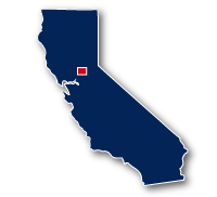
Map of the Marsh Creek Regional Trail
Marsh Creek Regional Trail

Marsh Creek Regional Trail
LENGTH:
8 miles
SURFACE:
paved
COMMUNITIES:
Oakley, Brentwood
HIGHLIGHTS:
Big Break Regional Shoreline, wetlands, residential neighborhoods, schools, local parks, commercial centers
NEARBY TRAILS:
Big Break Regional Shoreline Trail
RELATED LINKS:
The Marsh Creek Regional Trail is an 8-mile long paved pathway that spans between Oakley and Brentwood in Central California. The trail extends from the eastern edge of the Big Break National Shoreline which is along the Sacramento-San Joaquin River Delta.
The route of the trail is in a north to south direction. The trail follows alongside the channel for Marsh Creek and goes past schools, residential neighborhoods, local parks, commercial centers and connects to other regional recreational trails.
Conditions
The Marsh Creek Regional Trail is paved for the entire route, though there are access trails and an unpaved trail along portions of the Marsh Creek channel. The trail does have a number of crossings for major roadways at street level. There is a 0.4 mile long gap in the trail along Creek Road in Brentwood. The trail is open for bike riding, running and walking.
Communities
The Marsh Creek Regional Trail goes past the following communities: Oakley and Brentwood.
Points of Interest
The Marsh Creek Regional Trail goes past the following points of interest:
| Big Break Regional Shoreline |
| Delta Vista Middle School |
| Creekside Park |
| Sunset Park Athletic Complex |
| Brentwood Elementary School |
| Veterans Park |
| Brentwood Gamily Aquatic Complex |
| Creekside Park |
Nearby Trails
Big Break Regional Shoreline Trail: the two trails meet at the eastern end of the park, about 1 mile north of E. Cypress Road in Oakley.
Delta De Anza Regional Trail: the two trails come within 0.5 miles of each other along W. Cypress Road in Oakley.
Mokelumne Trail: the two trails meet along Sunset Road in Brentwood near the Sunset Park Athletic Complex.
End Points
The north end of the Marsh Creek Regional Trail is located at the eastern edge of the Big Break Regional Shoreline in Oakley, 1 mile north of E. Cypress Road and Main Street.
There is a 0.4 mile long gap in the trail along Creek Road in Brentwood.
The south end of the trail is located along Concord Avenue to the east of Vineyards Parkway in Brentwood. There is a parking area on the north side of Concord Road.
Resources
Following are links to official off-site resources to find out more details about the Marsh Creek Regional Trail in Oakely and Brentwood in Central California.


Tweet