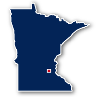
Map of the Minnesota River Bluffs Regional Trail
Minnesota River Bluffs Regional Trail

Minnesota River Bluffs Regional Trail
LENGTH:
13 miles
SURFACE:
unpaved - crushed aggregate
COMMUNITIES:
Chaska, Eden Prairie, Hopkins
HIGHLIGHTS:
rail trail, Riley Lake Park, Miller Park, Shady Oak Lake,
NEARBY TRAILS:
Cedar Lake LRT Regional Trail
North Cedar Lake Regional Trail
Lake Minnetonka Regional Trail
Chaska Open Space Trails
RELATED LINKS:
The Minnesota River Bluffs Regional Trail is a 13-mile long unpaved pathway located in the southwest portion of the Twin Cities Metropolitan Area in Central Minnesota. The route of the trail spans from the northeast side of Chaska to 11th Avenue S and Excelsior Boulevard in Hopkins.
The trail was constructed along an abandoned railroad right-of-way and travels through rural areas of woodlands and farmland, past lakes and parks and through suburban neighborhoods. The northeast end of the trail meets up with the Cedar Lake LRT Regional Trail that heads into the heart of Minneapolis.
Conditions
The Minnesota River Bluffs Regional Trail is unpaved with an improved surface of compacted aggregate. It may not be suitable for all types of bicycles. Check with the Three Rivers Park District for the condition of the trail and any closures.
Communities
The Minnesota River Bluffs Regional Trail goes past the following communities: Chaska, Eden Prairie and Hopkins.
Points of Interest
The Minnesota River Bluffs Regional Trail goes past the following points of interest:
| Lake Riley |
| Riley Lake Park |
| Bearpath Golf Course |
| Highway 212 Overpass |
| Miller Park |
| Central Middle School |
| Shady Oak Lake |
| Hopkins Central Park |
Nearby Trails
The Minnesota River Bluffs Regional Trail intersects multiple trails in the Chaska, Eden Prairie and Hopkins area. Many of these trails are multi-use paths that follow alongside major roadways. Other recreational trails along the way are regional trails that connect multiple communities.
Cedar Lake LRT Regional Trail: the tow trails meet at the northeast end of the Minnesota River Bluffs Regional Trail in Hopkins. This point is along 11th Avenue S to the south of Excelsior Boulevard.
North Cedar Lake Regional Trail: this trail takes off to the north from the Cedar Lake LRT Regional Trail just east of the Highway 169 interchange with Excelsior Boulevard in Hopkins. This location is about 0.9 miles from the northeast end of the Minnesota River Bluffs Regional Trail.
Lake Minnetonka Regional Trail: the southeast end of this trail is located at Mainstreet and 6th Avenue S, just 2 blocks from the Minnesota River Bluffs Regional Trail in Hopkins.
Chaska Open Space Trails: the southwest end of the Minnesota River Bluffs Regional Trail has been extended to meet up with the Chaska Open Space Trail system.
End Points
The southwest end of the Minnesota River Bluffs Regional Trail is located along Engler Boulevard to the west of Audubon Road in Chaska.
The northeast end of the trail is located along 11th Avenue S, just south of Excelsior Boulevard in Hopkins.
Resources
Following are links to official off-site resources to find out more details about the Minnesota River Bluffs Regional Trail, Minnesota.


Tweet