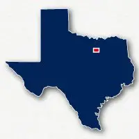
Map of bike paths / walking paths in the Colleyville, Keller, Watauga, Grapevine and Haltom City area
Recreational trails for walking, running and cycling in Colleyville, North Richland Hills, Keller, Watauga, Grapevineand Haltom City, Texas
The communities of Colleyville, North Richland Hills, Keller, Watauga, Grapevine and Haltom City are located in the area between Fort Worth and Dallas in Northeastern Texas.
There are numerous recreational trails in this area for bike riding, running and walking. Many of these trails are located in the natural areas alongside creeks or rivers, within the large parks or connect several parks, schools and neighborhoods.
Cotton Belt Trail
The Cotton Belt Trail is a 7.8-mile long paved pathway that extends from Browning Drive in North Richland Hills to John McCain Road in Colleyville. The trail follows an abandoned railroad corridor and goes past residential neighborhoods, parks and schools.
John Barfield Trail & Little Bear Creek Trail
The John Barfield Trail is a series of paved trail segments that span for about 3.5 miles through North Richland Hills.There are two short gaps in the trail where trail users will need to travel along streets to get to the next section.
The John Barfield Trail connects to the Cotton Belt Trail near W. Glade Road and Precinct Line Road. The trail also connects to the Little Bear Creek Trail system in Keller.
Big Bear Creek Greenbelt
The Big Bear Creek Greenbelt consists of two separate sections of paved trail systems along Big Bear Creek in Keller and Grapevine.
The Big Bear Greenbelt trails in Keller extend from Keller Sports Park on Chisolm Trail to Keller Smithfield Road. The trail then follows alongside Bear Creek Parkway to Preston Lane. The Big Bear Creek Greenbelt then kicks to the north wrapping around residential homes to end near Lakeridge Drive. The trail goes past Bear Creek Park and Bear Creek Intermediate School and connects to the Parks at Town Center Path and the multi-use path alongside Preston Way along the route.
The Big Bear Greenbelt in Grapevine is a paved pathway that extends for over 3 miles from Pool Road and 12 Oaks Lane and Hall Johnson Road near Wonder Way. The trail goes past residential neighborhoods, through Parr Park and under State Route 121
Walkers Creek Trail and North Electric Trail
The Walkers Creek Trail and the North Electric Trail form a system of paved pathways that extend for about 3.5-miles within North Richland Hills.The two trails meet at Walker's Creek Park north of Emerald Hills Way. The park is to the northwest of Tarrant County College Northeast Campus.
The North Electric Trail connects to the Cotton Belt Trail at Dick Faram Park on Amundson Drive to the east of Davis Boulevard. The North Electric Trail goes past Smithfiled Middle School and The Lakes at Hometown.
The Walkers Creek Trail extends from Walker's Creek Park to Holiday Lane and Dick Lewis Drive.
Arcadia Trail Park
Arcadia Trail Park is a large park located in Fort Worth to the north of Haltom City and to the north of Western Center Boulevard. The park has miles of paved pathways that connect the residential neighborhoods and schools in this area.
Buffalo Ridge Park
Buffalo Ridge Park is a large park located in Haltom City, to the east of N. Beach Street and just south of Arcadia Trail Park and Western Center Boulevard. The park has over 2-miles of paved pathways that connect the local neighborhoods and Haltom High School.
Lake Grapevine Trails
Lake Grapevine is a large reservior located in this north of the Dallas/Fort Worth area. There are hiking and bike riding trails located along the shores within the City of Grapevine. The C. Shane Wilbanks Trail is a 3.4 mile long paved pathway that connects the trail in Oak Grove Park and to the trails in Horseshoe Trails Park along the shores of Lake Grapevine. Be aware that the tails along the lakeshore will be inundated and unpassable during periods of high water.
Resources
Following are links to official off-site resources to find out more details about the recreational trails located in Colleyville, Texas.


Tweet