

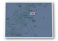
Map of the Longmont Boulder Regional Trail
Longmont-to-Boulder Regional Trail
Longmont-to-Boulder Regional Trail
LENGTH:
10 miles
SURFACE:
unpaved / paved
COMMUNITIES:
Longmont, Niwot, Gunbarrel, Boulder
HIGHLIGHTS:
views of the Indian Peaks, grasslands, rural residential communities, creeks, wildlife
NEARBY TRAILS:
Left Hand Greenway
Pleasant View Path
Niwot Trails
RELATED LINKS:
The Longmont-to-Boulder Regional Trail (LoBo Trail) is a series of unpaved and paved pathways that stretch for over 10 miles between Longmont and Boulder in Boulder County, Colorado. The northeast of the LoBo Trail connects to the Left Hand Greenway at Hover Road in Longmont. From this location the LoBo Trail heads to the southwest going through natural areas alongside Left Hand Creek for a short stretch. The trail then follows alongside the Diagonal Highway passing farmland then drops to the south to travel through the residential neighborhoods of Niwot. Within Niwot, the LoBo Trail allows a connection to the network of recreational trails that wander through this rural community.
Farther to the south, the LoBo Trail follows alongside the Boulder and Left Hand Ditch past residential areas and stops at Lookout Road. At this point, trail users need to use the local streets to connect to the next section of the trail. The trail picks up again along Twin Lake Road and goes past Twin Lakes Open Space then follows the wooded area alongside a ditch that wanders through residential areas. At Spine Road, trail users can head south to travel along the unpaved Cottonwood Trail that reaches as far as Independence road.
Conditions
The Longmont-to-Boulder Regional Trail is unpaved for much of its rout, with paved areas in some locations. The trail is graded, but is not suitable for all types of bicycles. The trail is open for bike riding and hiking.
Communities
The Longmont-to-Boulder Regional Trail goes past the following communities: Longmont, Niwot, Gunbarrel and Boulder.
Points of Interest
The Longmont-to-Boulder Regional Trail goes past the following points of interest:
| Left Hand Grange Park |
| Monarch Park |
| Eaton Park |
| Twin Lakes Open Space |
| Gunbarrel Commons Park |
Nearby Trails
Left Hand Greenway: the two trails meet at Hover Road to the south of the Diagonal Highway in Longmont.
Niwot Trails: the LoBo Trail intersects the recreational trail system in Niwot in a number of locations.
Boulder Trails: the south end of the LoBo Trail allows a connection to other recreational trails in the City of Boulder.
End Points
The Longmont-to-Boulder Regional Trail has three separate sections in which trail users need to use local streets to reach the next section.
The northeast end of the trail is located along S. Hover Road, 0.2 miles south of Pike Road in Longmont.
The southwest end of the trail is located at Independence Road to the east of Foothills Parkway in Boulder.
Resources
Following are links to official off-site resources to find out more details about the Longmont-to-Boulder Regional Trail, Colorado

Tweet