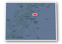
Map of the Ralston Creek Trail
Ralston Creek Trail

Ralston Creek Trail
LENGTH:
12.5 miles
SURFACE:
paved
COMMUNITIES:
Arvada
HIGHLIGHTS:
natural areas along the creek, residential neighborhoods, local parks, Olde Town Arvada, golf courses, Blunn Reservoir
NEARBY TRAILS:
Fairmount Trail
Clear Creek Trail
RELATED LINKS:
The Ralston Creek Trail is a 12.5-mile long paved pathway that extends from Highway 93 to Interstate 76 in Arvada, Colorado. The trail is located to the northwest of Downtown Denver.
The trail travels though the natural areas alongside Ralston Creek as it wanders through the residential and commercial areas of Arvada. The route includes numerous parks and open spaces, as well as a golf course and a couple of schools. The trail travels just a few blocks of Historic Old Town Arvada which has restaurants and shops.
The west end of the Ralston Creek Trail allows a connection to the Fairmount Trail , an unpaved hiking trail that wraps around North Table Mountain. The east end of the Ralston Creek Trail intersects the Clear Creek Trail that eventually connects to the South Platte River Trail.
Conditions
The Ralston Creek Trail is paved for the entire route. The trail is open for bike riding, running and walking.
Communities
The Ralston Creek Trail goes past the following communities: Arvada.
Points of Interest
The Ralston Creek Trail goes past the following points of interest:
| Long Lake Ranch Park | Davis Lane Park |
| Fairmount Trail | Campbell Elementary School |
| Blunn Reservoir | Oak Park |
| Tucker Lake | Arvada Tennis Center |
| Bird's Nest Disk Park | Ralston Cove Park |
| Westwoods Golf Course | The Ralston Central Park |
| Maple Valley Park | Hokinson Park |
| Shadow Mountain Park | John Roberts DGC |
| Ralston Valley Park | Old Town Arvada |
| Arvada Skate Park | Creekside Park |
| Danny Kendrick's Park East | Gold Strike Park |
Nearby Trails
The Ralston Creek Trail allows connections to several other recreational trails in the area.
Fairmount Trail: the trails meet at W. 64th Avenue to the east of Highway 93 in Arvada.
Clear Creek Trail: the trails meet to the northwest of the interchange between Interstate 76 and Sheridan Boulevard in Arvada.
End Points
The west end of the Ralston Creek Trail is located at W. 64th Avenue to the east of Highway 93 in Arvada.
The east end of the trail is located to the northwest of the interchange between Interstate 76 and Sheridan Boulevard.
Resources
Following are links to official off-site resources to find out more details about the Ralston Creek Trail in the Denver Metro area of Colorado.


Tweet