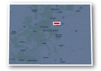
Map of the C-470 Multi-Use Trail
C-470 Multi-Use Trail

C-470 Multi-Use Trail
LENGTH:
20 miles
SURFACE:
paved
COMMUNITIES:
Golden, Lakewood, Ken Caryl, Highlands Ranch
HIGHLIGHTS:
views of Red Rocks, grasslands of the high prairie, Chatfield Reservoir
NEARBY TRAILS:
Bear Creek Trail
Weaver Gulch Trail
Mary Carter Greenway Trail
High Line Canal Trail
Centennial Trail
RELATED LINKS:
The C-470 Multi-Use Trail is a 20-mile long paved pathway that follows alongside Highway C-470 on the southwest side of the Denver Metro area. The trail extends from just south of 6th Avenue and Interstate 70 in Golden to a point east of the north end of Chatfield State Park in Highlands Ranch. The trail goes past large parks, open spaces and residential communities. The trail is used by cyclists that are commuting or like a straight stretch of trail with few curves.
The trail has nice views of the Red Rocks area of the foothills west of Denver as well as going through miles of high prairie grasslands. Near Morrison, the trail conjoins with the Bear Creek Trail, that heads east as far as the South Platte River Trail. The south end of the C-470 Multi-Use Trail goes through Chatfield State Park and connects to the many trails in the park as well as the Mary Carter Greenway Trail. At its terminus, the C-470 Multi-Use Trail connects with the High Line Canal Trail.
Conditions
The C-470 Multi-Use Trail is paved for the entire route. It is open for bike riding, walking and running. There are very long stretches between road crossings.
Communities
The C-470 Multi-Use Trail goes past the following communities: Golden, Jefferson County, Morrison, Lakewood, Ken Caryl and Highlands Ranch.
Points of Interest
The C-470 Multi-Use Trail goes past the following points of interest:
| William Frederick Hayden Park on Green Mountain |
| Matthew / Winters Park |
| North Dinosaur Park |
| Bear Lake Regional Park |
| Robert A. Easton Regional Park |
| The Meadows Golf Club |
| Chatfield State Park |
| Chatfield Reservoir |
| Flyin' B Park |
Nearby Trails
The C-470 Multi-Use Trail allows connections to several other regional recreational trails in the area.
Bear Creek Trail: at Bear Creek Lake Regional Park north of Highway 295.
Weaver Gulch Trail: at 3/4 mile south of Highway 285.
Mary Carter Greenway Trail: at the north end of Chatfield State Park.
High Line Canal Trail: Plaza Drive in Highlands Ranch. Trail users can use the High Line Canal Trail to connect to the Centennial Trail that follows alongside Highway E-470 as far as Parker Road.
End Points
The northwest end of the C-470 Multi-Use Trail is located at the end of W. 4th Avenue on the southeast side of Interstate 70 in Golden.
The southeast end of the trail is located just north of Flyin' B Park along Plaza Drive in Highlands Ranch. This point is half a mile east of the South Santa Fe Drive and C-470 interchange.
Resources
Following are links to official off-site resources to find out more details about the C-470 Multi-Use Trail in Denver Metro, Colorado.


Tweet