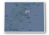
Map of the Mary Carter Greenway
Mary Carter Greenway

Mary Carter Greenway
LENGTH:
8 miles
SURFACE:
paved
COMMUNITIES:
Denver, Englewood, Littleton, Highlands Ranch
HIGHLIGHTS:
South Platte River, Chatfield Reservoir, local parks
NEARBY TRAILS:
South Platte River Trail
Bear Creek Trail
Big Dry Creek Trail
Littles Creek Trail
Lee Gulch Trail
Mineral Avenue Trail
High Line Canal Trail
C-470 Bikeway
Chatfield State Park Trails
RELATED LINKS:
The Mary Carter Greenway is an 8-mile long paved pathway that travels through the natural areas alongside the South Platte River Trail through the cities of Englewood and Littleton on the south side of the Denver Metro area. The greenway is a part of the Colorado Front Range Trail system and serves as the southern extension of the South Platte River Trail. The Mary Carter Greenway also connects to other recreational trails along its route and at the south end connects to the trails at Chatfield State Park.
The Mary Carter Greenway is a great place for a family outing and is used for cyclists commuting to work. It travels past many local parks and designated open spaces and goes past numerous ponds along the river. It is a great place to do some bird watching and experience the natural riparian habitat. The trail crosses the South Platte River in a number of locations with its own pedestrian bridges and travels along both sides of the river to either side of Belleview Avenue in Littleton.
Conditions
The Mary Carter Greenway is paved for the entire route. The trail is open for non-motorized uses such as bike riding, walking and running. There are relatively few street crossings and underpasses for most of the major thoroughfares.
Communities
The Mary Carter Greenway goes near the following communities: Denver, Englewood, Littleton and Highlands Ranch.
Points of Interest
The Mary Carter Greenway goes past the following points of interest:
| River Point at Sheridan shopping center |
| Broken Tee Golf Course |
| Centennial Park |
| Big Dry Creek Trail |
| Littleton Golf and Tennis Club |
| Littles Creek Trail |
| Hudson Gardens |
| Lee Gulch Trail |
| Reynolds Landing Park |
| South Platte Park |
| Eaglewatch Lake |
| South Platte Reservoir |
| Chatfield State Park |
| C-470 Bikeway |
Nearby Trails
The Mary Carter Greenway connects to several other recreational trails along the route, including:
South Platte River Trail: along South Platte River Drive to the south of W. Hampden Avenue in Englewood.
Bear Creek Trail: along South Platte River Drive to the south of W. Hampden Avenue in Englewood.
Big Dry Creek Trail: south of W. Union Avenue in Englewood.
Littles Creek Trail: south of W. Bowels Avenue in Littleton.
Lee Gulch Trail: at Lee Gulch Park between W. Bowels Avenue and W. Mineral Avenue and west of S. Santa Fe Drive in Littleton.
W. Mineral Avenue Multi-Use Path: W. Mineral Avenue, west of S. Santa Fe Drive.
C-470 Bikeway: south of C-470 at the north end of Chatfield State Park.
Chatfield State Park Trails: there are numerous paved and unpaved trails in the park at the south end of the Mary Carter Greenway.
End Points
The north end of the Mary Carter Greenway Trail is southwest of the interchange of W. Hampden Avenue and S. Santa Fe Drive, adjacent to the River Point at Sheridan shopping center. This location is also the intersection with the South Platte River Trail and the Bear Creek Trail.
The south end of the Mary Carter Greenway is located a point at the north end of Chatfield State Park and Chatfield Reservoir. This location is west of the interchange between C-470 and S. Santa Fe Drive. The end point can be accessed from within the state park, but there is also an access point on the northside of C-470 and east of S. Platte Canyon Road on the S. Platte Reservoir Access Road.
Resources
Following are links to official off-site resources to find out more details about the Mary Carter Greenway, Colorado


Tweet