

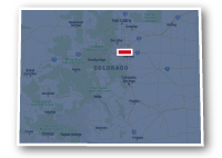
Map of the South Platte River Trail
South Platte River Trail
South Platte River Trail
LENGTH:
18 miles
SURFACE:
paved
COMMUNITIES:
North Denver, Downtown Denver, South Denver,
HIGHLIGHTS:
parks, Pepsi Center, Auraria Campus, Confluence Park, Downtown Denver, natural areas, River Point at Sheridan Shopping Center
NEARBY TRAILS:
South Platte River Trail (north)
Niver Creek Trail
Clear Creek Trail
Sand Creek Regional Greenway
Cherry Creek Trail
Lakewood Gulch Trail
Weir Gulch Trail
Sanderson Gulch Trail
West Harvard Gulch Trail
Little Dry Creek Trail
Bear Creek Trail
Mary Carter Greenway Trail
RELATED LINKS:
The portion of the South Platte River Trail that is located in Denver is a 18-mile long paved pathway that follows the South Platte River through the heart of the Denver Metro area. Another portion of the South Platte River Trail heads to the north from Denver to travel through Adams County. The Mary Carter Greenway Trail heads to the south from Denver to travel through Littleton.
The Denver portion of the South Platte River Trail starts at E. 88th Avenue and travels south through Downtown Denver and the neighborhoods of South Denver to Hampden Avenue. The South Platte River Trail is part of the Colorado Front Range Trail and connects to several other regional trails at both ends and along its route. The South Platte River Trail, in combination with the Mary Carter Greenway Trail, is also referred to as "The Greenway Trail along the South Platte".
The South Platte River Trail travels through the natural area alongside the river going past several lakes, residential neighborhoods, local parks, golf courses, industrial areas, commercial districts and designated open space. It the Downtown Denver area, the trail goes through Confluence Park, past the Pepsi Center, Auraria Campus, Sports Authority Field at Mile High, Elitch Gardens and many other attractions in the area.
Conditions
The South Platte River Trail is paved for the entire route. There are some street crossings, but a number of underpasses or overpasses for crossing the major roadways. The trail can get congested in some areas and as with any other urban area, trail users should be aware of their surroundings and be cautious with their valuables.
Communities
The South Platte River Trail goes near the following neighborhoods: North Denver, Downtown Denver and South Denver.
Points of Interest
The South Platte River Trail goes past the following points of interest:
| Platte River Trailhead Park | Auraria Campus |
| Thornton Gravel Ponds | Lower Lakewood Gulch Park |
| Historical Riverside Cemetery | Frog Hollow Park |
| Northside Park | Phil Milstein Park |
| Globeville Landing Park | Valverde Park |
| City of Cuenevaca Park | Habitat Park |
| Commons Park | Vanderbuilt Park |
| Confluence Park | Overland Pond Park |
| Centennial Park | Overland Golf Course |
| Elitch Gardens Amusement Park | Ruby Hill Park |
| Children's Museum of Denver | Pasquenial's Landing |
| Crescent Park | Grant Frontier Park |
| Pepsi Center | River Point at Sheridan Shopping Center |
Nearby Trails
The South Platte River Trail intersects numerous other recreational trails along its route, including the following:
South Platte River Trail (north): E. 88th and Colorado Boulevard.
Niver Creek Trail: Steele Street and E 78th Avenue.
Clear Creek Trail: southeast of E. 74th Avenue and York Street.
Sand Creek Regional Greenway: Interstate 270 and E. 64th Avenue.
Cherry Creek Trail: Confluence Park, Speer Boulevard and Little Raven Street.
Lakewood Gulch Trail: south of W. Colfax and east of Decatur Street.
Weir Gulch Trail: W. 9th Avenue, east of Bryant Street.
Sanderson Gulch Trail: northwest corner of the Overland Golf Course at W. Florida Avenue and S. Platte River Drive.
West Harvard Gulch Trail: 1/2 mile north of Dartmouth Avenue and west of S. Santa Fe Drive.
Little Dry Creek Trail: W. Dartmouth Avenue west of S. Santa Fe Drive.
Bear Creek Trail & Mary Carter Greenway Trail: River Point at Sheridan shopping center, southwest of the interchange of Hampden Avenue and S. Santa Fe Drive.
End Points
The north end of the South Platte River Trail is located at Platte River Trailhead Park at E. 88th Avenue and Colorado Boulevard in Thornton. There is a trailhead with parking at this location. This is also the location where the South Platte River Trail connects to the South Platte River Trail - Adams County that heads to the north.
The south end of the trail is located at South Platte River Drive and River Point Parkway. This point is adjacent to the River Point at Sheridan shopping center to the southwest of the interchange of S. Santa Fe Drive and Hampden Avenue.
Resources
Following are links to official off-site resources to find out more details about the South Platte River Trail, Colorado

Tweet