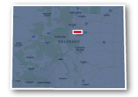
Map of the Sand Creek Greenway
Sand Creek Greenway

Sand Creek Greenway
LENGTH:
15 miles
SURFACE:
paved / unpaved
COMMUNITIES:
Denver, Commerce City, Aurora
HIGHLIGHTS:
natural areas along the creek, connections to South Platte River Trail & High Line Canal Trail, local parks
NEARBY TRAILS:
South Platte River Trail
Westerly Creek Trail
High Line Canal Trail
RELATED LINKS:
The Sand Creek Greenway is a 15-mile long paved and unpaved pathway located on the northeast side of the Denver Metro area. The trail connects to the South Platte River Trail on the north side of Denver, then heads east through Commerce City and Aurora. The east end of the Sand Creek Greenway is located on the east side of Buckley Air Force Base in Aurora.
The Sand Creek Greenway goes through the natural area alongside of Sand Creek as it goes past commercial and industrial areas. The trail also goes past several local parks, golf courses and residential neighborhoods. The Sand Creek Trail has connections to the paved trails in the Northfield at Stapleton area.
Conditions
The Sand Creek Greenway has paved and unpaved sections. There was a great deal of damage to the trail system during the floods of 2013, but the repairs to the trail have been extensive. The trail is open for non-motorized use such as bike riding, walking and running. There are underpasses for many of the major street crossings.
Communities
The Sand Creek Greenway goes past the following communities: Denver, Commerce City and Aurora.
Points of Interest
The Sand Creek Greenway goes past the following points of interest:
| South Platte River Trail |
| Wetland Park |
| Central Park at Stapleton |
| Central Park Recreation Area |
| Bluff Lake Nature Center |
| Isabella Bird Community School |
| Sand Creek Park |
| Morrison Nature Center |
| Star K. Ranch |
| High Line canal Trail |
| Aurora Sports Park |
| Buckley Air Force Base |
Nearby Trails
The Sand Creek Greenway connects to other recreational trails along its route as well as trails within the local parks.
South Platte River Trail: east of York Street and just south of Interstate 270
Commerce City Trail System: Quebec Street and Interstate 270.
Westerly Creek Trail & Central Park at Stapleton trails: halfway between Central Park Boulevard and Havana Street.
High Line Canal Trail: to the south of Quebec Street and east of N. Airport Road.
End Points
The northwest end of the Sand Creek Greenway is located to the east of York Street and just south of Interstate 270 where it intersects the South Platte River Trail.
The southeast end of the is along E. 6th Avenue, about 2 miles east of N. Airport Boulevard in Aurora.
Resources
Following are links to official off-site resources to find out more details about the Sand Creek Greenway in Denver, Commerce City and Aurora, Colorado.


Tweet