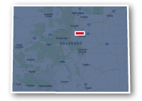
Map of the Toll Gate Creek Trail
Toll Gate Creek Trail

Toll Gate Creek Trail
LENGTH:
1.2 miles + 6 miles + 3 miles
SURFACE:
paved
COMMUNITIES:
Aurora
HIGHLIGHTS:
natural areas along Toll Gate Creek, local parks, residential neighborhoods
NEARBY TRAILS:
Sand Creek Greenway
Powerline Trail
West Toll Creek Trail
Cherry Creek Spillway Trail
High Line Canal Trail
RELATED LINKS:
The Toll Gate Creek Trail is a system pf paved pathways totally over 11 miles. The trail has a number of different sections with gaps in between. the trail meanders through the natural areas alongside the creek and goes past local parks, residential neighborhoods and commercial centers.
The northern section is 1.2 miles long and connects to the Sand Creek Greenway near Sand Creek Park at Fitzsimons Parkway and Peoria Street.
The longest section of the Toll Gate Creek Trail is 6.6 miles long and spans between E. Alameda Parkway and E. Quincy Avenue. The north end of this section connects to High Line Canal Trail. The south end allows a connect to the trail around Quincy Reservoir.
The southern section is around 3 miles long and wanders through the natural areas along the creek to the south of Quincy Reservoir and to the north of Saddle Rock Golf Course.
Conditions
The Toll Gate Creek Trail is paved for the entire route. The trail is open for bike riding, running and walking. Much of the route for the trail is located away from roadways. there are underpasses at some major streets, but there are also some road crossings
Communities
The Toll Gate Creek Trail goes past the following neighborhoods in Aurora: Morris Heights, Centre Pointe, Lakeshore, Kingsborough, Seville, Ridgeview Glen, Waters Edge an Saddle Rock.
Points of Interest
The Toll Gate Creek Trail goes past the following points of interest:
| Park Lane Elementary School |
| Park Lane Swimming Pool |
| Sand Creek Park |
| City Center Marketplace |
| Toll Gate Park |
| Toll Gate Elementary School |
| Kingsborough Park |
| Horseshoe Park |
| Hampden Run Park |
| Summer Valley Park |
| Cimarron Elementary School |
| Grandview Dog Park |
| Lookout Pool |
| Thunder Ridge Middle School |
Nearby Trails
Sand Creek Greenway: the north section of the Toll Gate Creek Trail connects to the Sand Creek Greenway at Sand Creek Park. The park is located at Fitzsimons Parkway and Peoria Street.
High Line Canal Trail: the two trails meet at E. Alameda Parkway to the east of S. Chambers Road.
Powerline Trail, West Toll Gate Creek Trail and Cherry Creek Spillway Trail: The trails all meet at Horseshoe Park. The park is located to the south of E. Mexico Avenue and west of S. Buckley Road.
Quincy Reservoir Trail: the south end of the Toll Gate Creek Trail is across E. Quincy Avenue from Quincy Reservoir.
End Points
There are three main sections to the Toll Gate Creek Trail in Aurora.
The north section starts at Sand Creek Park at Fitzsimons Parkway and Peoria Street.
The middle section starts at E. Alameda Parkway to the east of S. Chambers Road. This section ends at E. Quincy Avenue to the east of S. Buckley Road.
The Southern section starts at S. Flanders Street off of S. Reservoir Road. This section has a few short gaps and ends at S. Ukraine Street.
Resources
Following are links to official off-site resources to find out more details about the Toll Gate Creek Trail in Aurora, Colorado.


Tweet