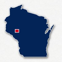
Map of bike paths / walking paths in the Eau Claire and Chippewa Falls area
Recreational trails for walking, running and cycling in Eau Claire and Chippewa Falls, Wisconsin
The cities of Eau Claire, Lake Hallie and Chippewa Falls are located in Western Wisconsin. They are all three situated along the Chippewa River.
There are two major Wisconsin State Trails that extend out from these cities, the Chippewa River State Trail and the Old Abe State Trail. There is also the Buffalo River State Trail that is located 16 miles to the south of Eau Claire.
The cities also have paved recreational trails located along the river, running through local parks or alongside major roadways. These are trails for walking, running and bike riding.
Chippewa River State Trail
The Chippewa River State Trail is a 30-mile long pathway built along and abandoned railroad right-of-way. The trail extends to the west from Lake Hallie, through Eau Claire and onto the community of Durand. Along the route, trail users can see the natural habitats of wetlands, prairies and thick forests along with sandstone bluffs. The trail is mostly paved in the urban sections and is unpaved in the rural sections.
The Chippewa River State Trail is open for hiking, cycling and dog walking. A Wisconsin State Trail Pass is required for bicycles.
Read more about the Chippewa River State Trail
Old Abe State Trail
The Old Abe State Trail is a 20-mile long paved trail that extends from Chippewa Falls to Cornell. The trail travels through wide open farmland and through thick forests. Much of the trail follows along the shores of the Chippewa River. The Old Abe State Trail is open for hiking, bike riding and dog walking. A Wisconsin State Park Pass is required for cycling.
Read more about the Old Abe State Trail
Red Cedar State Trail
The Red Cedar State Trail is a 14.5-mile long unpaved pathway that extends from Menomonie to Dunnville in Western Wisconsin. The trail was constructed along an abandoned railroad right-of-way and much of the trail follows alongside the meandering Red Cedar River. The trail goes through agricultural areas, prairies, wetlands and thick forests.
The north end of the trail is just across the Broadway Street bridge from the campus of University of Wisconsin - Stout. Near its south end, the trail goes past the Dunnville State Wildlife Area. The south end of the Red Cedar State Trail intersects with the Chippewa River State Trail.
Read more about the Red Cedar State Trail
Resources
Following are links to official off-site resources to find out more details about the recreational trails in Eau Claire, Chippewa Falls and Lake Hallie, Wisconsin.


Tweet