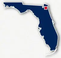
Map of bike paths / walking paths in Jacksonville, FL
Recreational trails for walking, running and cycling in Jacksonville, Florida
Jacksonville is located in Northeastern Florida. The city is situated along the St. John River and is just west of the Pacific Ocean.
Jacksonville Riverwalks
Downtown Jacksonville is situated along a tight bend in the the St Johns River. There are over 2.5 miles of paved Riverwalks located on both the north and south banks of the river with pedestrian walks along the bridges for the Acosta Expressway and S. Main Street. These paths allow visitors to stroll along the river watching the boat traffic and wildlife, visit a museum, get a bite at one of the local restaurants or visit the shops.
A number of multi-story office buildings and hotels are located along the waterfront, as well as the Jacksonville Landing shopping mall, the Times Union Center for the Performing Arts, the Jacksonville Museum of Science and History, the Wolfson Children's Hospital and Baptist Medical Center.
Read more about the recreational trails in Downtown Jacksonville
S-Line Urban Greenway
The S-Line Urban Greenway is a set of paved pathways totaling 2.25-miles that are located to the north of Downtown Jacksonville. The trails were constructed along an abandoned railroad right-of-way and cuts through residential and commercial areas. the trail goes through very pretty tree lined greenspaces along the way. The separate paved trails are coupled routes along connecting streets and the entire system stretches for 4.8 miles.
The 1.5-mile long south section of the S-Line Urban Greenway extends from Myrtle Avenue N, south of Kings Road, to Boulevard Street north of W. 8th Street.
The 1.75-mile long north section of the greenway extends from E. 21st Street east of Walnut Street to a point just east of Norwood Avenue and Carlton Street.
Jacksonville Baldwin Rail Trail
The Jacksonville Baldwin Trail is a 14.6-mile long paved pathway located to the west of Jacksonville. The trail follows an abandoned railroad right-of-way and takes a fairly straight route through the residential neighborhoods to the northwest side of Jacksonville and then cross country to Baldwin, going through thickly forested sections.
Read more about the Jacksonville Baldwin Rail Trail
Doctor's Lake Drive Bike Path
The Doctor's Lake Drive Bike Path is a 4.4-mile long paved trail that is located to the northwest of Doctor's Lake to the south of Jacksonville. The trail spans between Lakeside and Orange Park.
Black Creek Trail - Clay County
The Black Creek Trail is a 8-mile long paved pathway in Orange Park and Fleming Island located between Doctor's Lake and the St. John River to the south of Jacksonville. The trail follows alongside U.S. Highway 17 between Orange Park and Black Creek Park ot the south of Hibernia. The trail goes past residential neighborhoods, commercial areas, marinas and local parks.
Buccaneer Trail
The Buccaneer Trail is a 3.5 mile long paved pathway located in Big Talbot Island State Park. The trail wanders through the forest alongside Highway A1A.
Resources
Following are links to official off-site resources to find out more details about the recreational trails located in Jacksonville, Florida.


Tweet